Bendigo Regional Employment Precinct
The VPA is leading preparations for draft amendment C296gben to the Greater Bendigo Planning Scheme for the Bendigo Regional Employment Precinct (BREP). The VPA is working with the City of Greater Bendigo, state government agencies and service authorities to prepare the draft planning scheme amendment.
Public consultation is now closed
Public consultation on draft C296gben to the Greater Bendigo Planning Scheme is now closed. We are now reviewing all submissions and will reach out to submitters as required.
If you have any questions, please contact us via BREP@transport.vic.gov.au
For more information, refer to Bendigo Regional Employment Precinct | Engage Victoria
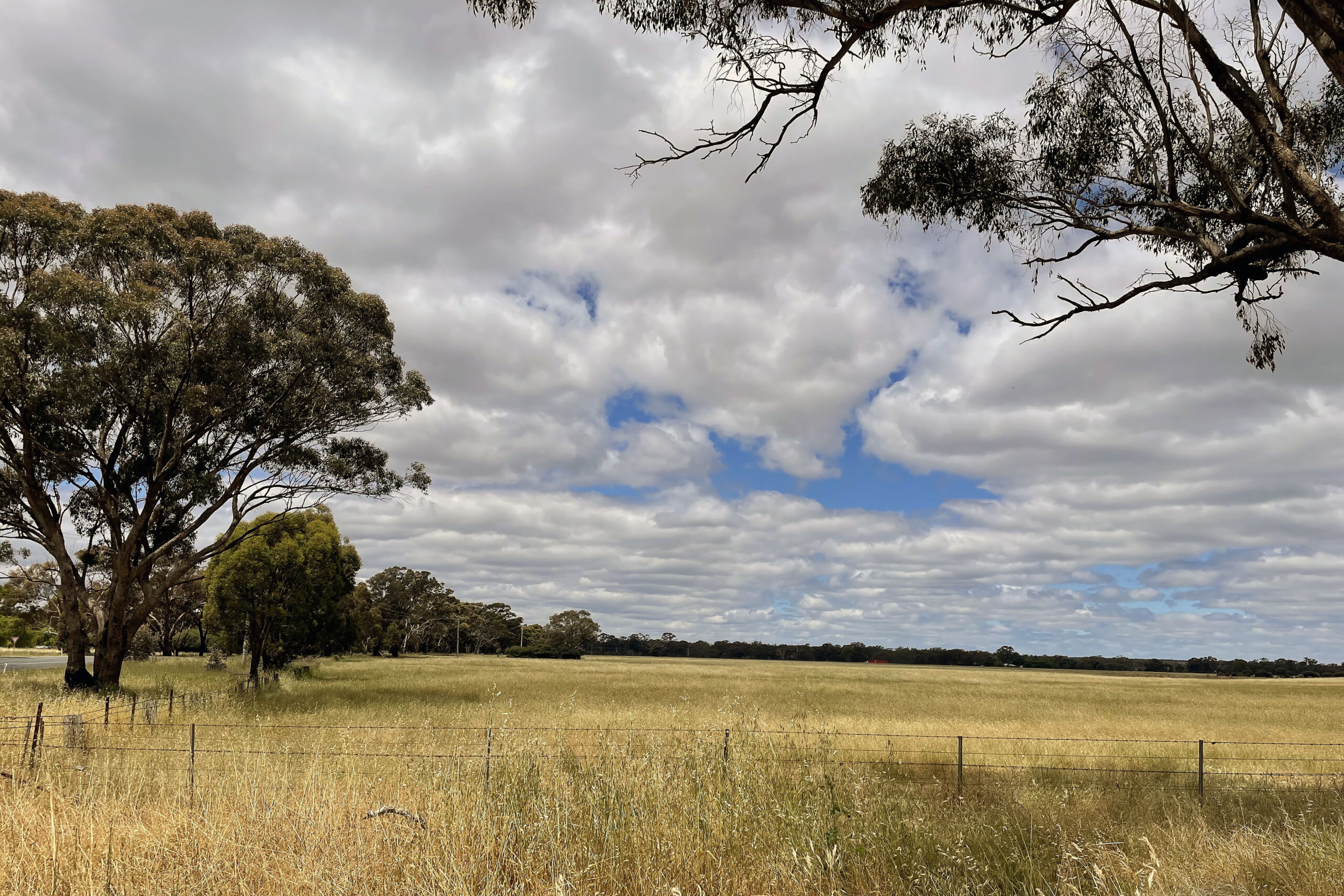
The Bendigo Regional Employment Precinct includes land currently used for farming
About the project
The Bendigo Regional Employment Precinct (BREP) is an important part of the Victorian Government’s strategy to address population growth, housing and employment demands. It is supported by the Greater Bendigo Industrial Land Development Strategy which sets out a strategic framework for the development of land and facilitation of investment to support industrial and employment growth in Bendigo.
The VPA (now formerly part of the Department of Transport and Planning) is preparing a planning scheme amendment for the BREP. This draft amendment package will include rezoning of land within the precinct from Farming Zone to Industrial 1 Zone (INZ1) and the application of a Development Plan Overlay.
The BREP will deliver 206 hectares of industrial land at full build out and provide access to around 3000 jobs. The precinct is directly south of the Marong Township and is bordered by the Wimmera Highway, Calder Alternative Highway, O’Sullivans Road and Cemetery Road.
A planning scheme amendment (PSA) involves either a change to a planning scheme map, a change to the written part of the scheme, or both.
Amendments to a planning scheme can have significant planning implications as they change the way land can be used or developed, which changes the basis of planning decisions in the future.
The VPA is facilitating a whole-of-government approach which includes consulting with all relevant stakeholders, including state government agencies, council, landowners, the Registered Aboriginal Party and local residents and businesses.
For more detail on the planning process to date, including the extensive research and analysis that has been undertaken, visit the Supporting Documentation tab on the Bendigo Regional Employment Precinct project page.
A Development Plan Overlay (DPO) is a planning tool used to implement a plan to guide the future use and development of land. It provides certainty about the nature of the use or development before a permit under the zone can be granted.
A development plan prepared under a DPO sets out the preferred land use and development outcomes for a site. It identifies the necessary services and infrastructure required to support development, ensuring that large parcels of land are delivered in a coordinated and integrated manner.
Development plans are prepared by the landowner (or development proponent), and once approved, all planning permit applications must generally comply with the endorsed development plan.
The project commenced as a VPA-led Precinct Structure Plan (PSP) process, supported by a comprehensive suite of background technical studies. While a full PSP provides a detailed and prescriptive framework, over time it became evident that a more tailored approach would better suit the employment-focused nature of the BREP.
As planning progressed, it was determined that an alternative pathway would deliver greater flexibility, efficiency and alignment with investment readiness, while still maintaining strategic and environmental oversight. The transition from a PSP to an alternative planning pathway, includes:
- Continuation of PSP technical background studies to underpin the amendment.
- Introduction of local planning policy to articulate the strategic intent across the precinct.
- Application of a Development Plan Overlay (DPO) to guide subdivision staging, infrastructure delivery, and design outcomes.
- Rezoning to Industrial 1 Zone (INZ1) to establish a permissive industrial land-use framework.
This approach ensures there is no loss of evidentiary basis or continuity in planning rigour. Instead, it streamlines statutory planning processes, enhances delivery certainty, and provides a fit-for-purpose planning framework that supports the industrial focus of the precinct.
Key themes from the previous engagement are:
- Employment: The BREP should attract a range of economic development opportunities, industries and jobs ranging from state-of-the-art industry, and manufacturing to service industry supporting cultural tourism opportunities.
- Transport: The BREP should leverage of its accessible location, freight network and location whilst ensuring for improvements to connections to the Marong township and regional freight networks.
- Water and drainage: BREP planning should holistically manage water and drainage to minimise flooding risks from Bullock Creek and Wilson’s Hill Channel, improve water quality outcomes and improve ecological values.
- Character, landscape and heritage values: BREP planning should respect and reinforce the highly valued local heritage, rural landscape and visual character of Marong. It also provides an important opportunity to explore and embed Aboriginal cultural heritage outcomes and value within the future precinct.
- Amenity: The BREP should create a high amenity precinct by incentivising high value-added industry, managing location of industry to ensure amenity impacts are minimised and support the provision of high-quality landscape treatments at key gateways.
For more detail on the planning process to date, visit the Supporting Documentation tab on the Bendigo Regional Employment Precinct project page.
The Greater Bendigo Industrial Land Development Strategy (GBILDS) provides a 30-year framework for industrial land supply identifying priority projects to address a shortage of large, serviced industrial lots in Greater Bendigo. It emphasises coordinated planning, infrastructure sequencing and market readiness to maintain Bendigo’s competitiveness in attracting industrial investment.
Within the GBILDS, the BREP has been identified as the highest priority for short- to medium-term industrial land delivery. Please refer to the website of Amendment C282gben Industrial Land Development Strategy.
Transport and traffic
The VPA-commissioned Marong Transport Network Assessment shows that the Marong road network can handle the extra traffic from the BREP, provided certain upgrades are delivered over time.
Working with the Department of Transport and Planning and the City of Greater Bendigo, three priority intersection upgrades have been identified under the BREP Guideline for Preparing Shared Infrastructure Delivery and Funding Plan:
IT2 – Calder Alternative Highway / Wimmera Highway
Recommended upgrade: An interim roundabout to manage traffic movements safely in the early stages of precinct development.
IT3 – Calder Highway / Calder Alternative Highway
Recommended upgrade: Signalisation to improve safety and traffic flow at this major junction.
IT5 – Calder Highway / Allies Road
Recommended upgrade: Signalisation to support increased turning movements and provide safer access.
To make sure traffic is properly managed as the precinct develops, developers will be required to do the following before they can start developments:
- Prepare a transport impact report – This report must show how their project will affect the local and main roads, and what improvements are needed to keep traffic safe and flowing well.
- Prepare an infrastructure delivery and funding plan – This plan must set out the road and intersection upgrades needed to support their development, and when these upgrades should be delivered.
- Contributions to the cost of road upgrades – Developers must help pay for shared transport infrastructure. In some cases, they may also need to build part of the upgrade themselves.
- Enter into an agreement with Council or the State (if required) – This agreement ensures that the identified upgrades and contributions are delivered.
This approach ensures that roads are improved in step with development, traffic is managed safely, and the impact on the Marong community is minimised.
The planning scheme amendment does not determine the final outcome for O’Sullivans Road. While the concept plan under the proposed Schedule 34 to Development Plan Overlay identifies a possible future open-space corridor at full build-out of the BREP, the future use, function, interim access arrangements or potential closure of O’Sullivans Road will be assessed and determined through separate development plan and permit approvals outside this amendment process, once the local road layouts and access requirements are known.
Existing access for external users as well as all current access points from precinct land to O’Sullivans Road remain unchanged until development occurs and the new local road network and connections to the State freight network are constructed.
Project background
The Victorian Planning Authority (VPA) is a State Government statutory authority within the Department of Transport and Planning that reports to the Minister for Planning. The VPA is responsible for planning new suburbs and renewal sites in Victoria.
On the request of the City of Greater Bendigo (CoGB), the Minister for Planning appointed the VPA to lead the BREP project from conception to finalisation.
Throughout the project, we will work closely with the CoGB, State Government agencies, local community members, and landowners to ensure the plan considers and reflects their input.
The Minister for Planning has appointed the VPA as Planning Authority for this Amendment.
If the Amendment is approved, CoGB will become the responsible authority for assessing and endorsing development plans.
Next steps
Once a submission is made to the VPA, you will receive a notice to acknowledge it has been received.
After the consultation period ends, VPA staff will review all submissions received. As part of this process, VPA staff may contact submitters as required to further discuss their submission and any changes sought.
If required, draft Amendment C296gben may be subject to the VPA Projects Standing Advisory Committee (SAC). The SAC has been established to provide independent advice on draft planning scheme amendments to the VPA and the Minister for Planning.
While the VPA will seek to resolve issues raised by submitters, following the public consultation process, the Minister for Planning will be advised of the outcomes and provided with options to resolve submissions, including, but not limited to, referral to the SAC. If so, submitters will be contacted regarding next steps, process, and timing.
Probity and Governance
As the CoGB is a significant landowner within the BREP and Development Victoria commissioned by the CoGB to undertake the studies, a Probity Plan has been developed with governance arrangements which include:
- VPA as independent Planning Authority.
- A Project Charter and Governance Plan (publicly available).
- Conflict of interest declarations and transparent consultation.
- An independent probity health check documented in the Background Report.
Please refer to the detailed Project Charter and Governance Framework Plan for further information.
As both a major landowner within BREP and the municipal authority, the City of Greater Bendigo and the Victorian Planning Authority recognise the importance of carefully managing any potential conflicts of interest.
The VPA-led BREP program has been designed with strong probity measures.
These include:
- The VPA being appointed as the Planning Authority to lead precinct planning for BREP.
- Independent technical experts providing advice.
- Engagement with key government agencies.
- Public access to technical reports on the VPA project webpage.
- Open and inclusive community consultation and engagement.
- An independent review through the Planning Panels Victoria hearing process.
To ensure transparency, the City of Greater Bendigo also participates in two clearly separated roles:
- As the municipal authority – providing statutory planning and strategic advice
- As a landowner – engaged at the same stage as other landowners, with different staff representing this role to avoid conflicts of interest
To further strengthen integrity across the project, the Victorian Planning Authority (VPA) have jointly appointed a Probity Officer to oversee alignment with the established probity plan.
Planning Scheme Amendment
The Planning Scheme Amendment (PSA) intends to rezone the BREP as Industrial Zone 1. However, the Development Planning Overlay (DPO) schedule ensures that existing uses (such as residential) within the BREP can remain and continue operating providing any future works do not prejudice the future development aspirations of the BREP.
The DPO schedule has identified several lots as having the potential risk for contamination.
To ensure that these lots can be deemed suitable for sensitive purposes, permit conditions within the DPO schedule will require applicants on these sites to provide the environment assessment and/or audit process.
These conditions do not apply to buildings and works associated with the existing residential use established before the approval of the amendment.
The interface between BREP and rural properties will be managed at the development plan and permit stage via the Greater Bendigo Industrial Development Guidelines 2024.
The Guidelines recommend the use of landscape buffers or increased setbacks to carefully manage this sensitive interface. The Guidelines formed part of scheme amendment c982 to the City of Greater Bendigo Planning Scheme. The amendment is currently with the Minister of Planning for final approval.
The development plan overlay schedule sets rules for how development needs to treat these sensitive edges by showing public open space landscaping, including landscaping of roads, streets, walking and cycling tracks, waterways and retarding basins will be planned to create landscape and habitat corridors to transition to the rural setting. At the Marong Township interface, permit applications must demonstrate that their proposals include appropriate amenity buffers to sensitive uses, e.g. residential uses and open space adjacent to a residential zone, in accordance with EPA guidelines.
Windfall Gains Tax and Council Rates and Land Valuation
The Windfall Gains Tax applies to land in Victoria that receives a taxable value uplift of more than $100,000 as a result of a rezoning, such as from Farming Zone (FZ) to Industrial 1 Zone (IN1Z).
The tax is triggered when a planning scheme amendment changes the zone of the land. The Valuer-General Victoria determines the uplift in capital improved value of the land before and after rezoning. Landowners may apply to defer payment (in full or part and Interest applies) until the property is sold, developed, or 30 years after the rezoning, whichever occurs first.
For more information, please visit the State Revenue Office (SRO) website for detailed information at https://www.sro.vic.gov.au/windfall-gains-tax.
We recommend you seek advice from your accountant or request a private ruling from the SRO to understand how the tax may apply to your circumstances.
We will provide further updates on the timing of the rezoning as the planning scheme amendment progresses. The rezoning is anticipated to occur in the second half of next year (after the end of the 2025–26 financial year) subject to changes.
The City of Greater Bendigo uses a separate land-valuation system for rating purposes. We acknowledge your concern that rezoning may lead to a land-value uplift, which could have implications for council rates and, potentially, land tax.
For further information or discussion, please contact:
City of Greater Bendigo – Revenue and Valuations Team
(03) 5434 6000 / rates@bendigo.vic.gov.au
Environment, Biodiversity and Heritage
The VPA have commissioned detailed environmental assessments, including habitat mapping and analysis of protected species and ecosystems.
These technical reports have provided basis for measures included within the Development Plan Overlay to avoid or offset impacts on biodiversity and sensitive areas as much as possible.
The precinct design will also include strategies for managing stormwater and protecting natural waterways.
Sites of cultural or heritage value have been identified and considered in the planning process. Environmental values such as native vegetation and water corridors are being protected through careful precinct design, buffers and appropriate land uses.
Future development must follow the rules set out in the development plan overlay schedule, which are designed to protect the area’s natural features. This includes:
- Retention and protection of mature trees, including those in existing or future road reserves, with adoption of buffer zones around retained trees to avoid disturbance during construction and after development.
- Development requirements to respect the natural landscape of the Wilsons Hill Bushland Reserve and provide a minimum 50-metre setback to the Dry Creek corridor. This buffer protects waterway health, riparian vegetation, wildlife habitat and the natural form of the creek.
- Using these buffer areas as green links that support wildlife, walking paths and drainage functions.
These protections are required in a development plan before any subdivision or building can be approved.
Parts of the precinct fall within Aboriginal cultural heritage sensitivity areas. These areas are important to Dja Dja Wurrung People. This means a Cultural Heritage Management Plan may be required before development can start. Developers are required to prepare their plans collaboration with DJAARA during the preparation of a Development Plan to identify and respect cultural values.
Some sites in the precinct are on the Victorian Heritage Inventory. These places are protected under the Heritage Act 2017, which is separate from the planning process. This requires developers to obtain consent from Heritage Victoria before any works that could disturb these sites. The planning permit process cannot override the Heritage Act.
The planning approach embeds sustainability through integrated water management and preserving high value ecological habitat. Green spaces and vegetation will play a key role in creating a climate-adaptive employment precinct:
- Integrated water management: New development must manage stormwater carefully, protect Dry Creek and use water efficiently
- Green buffers and habitat protection: Key ecological areas are preserved and strengthened through landscaping and tree planting to help cool the precinct.
- Climate-responsive design: More shade, vegetation and open spaces will improve comfort and resilience as the climate warms. The BREP also follows Ministerial Direction 22 (Environmentally Sustainable Development) and is guided by the Bendigo Regional Employment Precinct – Sustainable Development Opportunities Report (HIP V. HYPE, March 2024), which identifies practical sustainability measures for future development.
The DPO schedule will require future development plans to include an Environmentally Sustainable Development (ESD) Assessment which is to present opportunities or constraints for achieving sustainable design outcomes. These could include:
- Opportunities for renewable energy and battery energy storage systems at a precinct or lot scale.
- Opportunities for the subdivision and infrastructure to minimise greenhouse gas emissions and encourage renewable energy generation.
- Opportunities to reduce greenhouse gas emission from the construction and ongoing operation of any buildings toward net zero.
- Encouraging greater tree canopy throughout the precinct.
In addition to the DPO requirements at the planning stage, all new industrial buildings must comply with current and future energy-efficiency standards under the Building Regulations. This includes meeting NCC requirements for building fabric and insulation, glazing performance, lighting efficiency and controls, and other measures that minimise operational energy demand.
The BREP has been carefully planned to ensure development does not increase flood risk within the precinct or for downstream communities by:
- A buffer and setbacks along Dry Creek help maintain natural water flows, protect vegetation and allow the creek to safely convey stormwater during heavy rain.
- New development must slow, treat and store stormwater on-site before it enters waterways within the BREP or is released as low-flow discharge into Bullock Creek. This reduces peak flows and improves water quality.
- Each development plan must fund and deliver the drainage infrastructure in the right order to manage stormwater safely as the development plan area grows.
The planning process has been informed by consultation with the North Central Catchment Management Authority to ensure the approach aligns with regional floodplain and waterway management requirements. The development plan overlay schedule includes specific requirements for assessing and managing flood risk, drainage design and the staging of stormwater infrastructure. Developers must demonstrate that their designs safely manage stormwater before any subdivision or buildings can be approved. These measures ensure the precinct can grow while protecting local waterways and avoiding downstream impacts.
The Marong-Bullock Creek Cemetery, established in 1861, is a place of shared significance for both Aboriginal and non-Aboriginal people in the region. It also provides evidence of Dja Dja Wurrung people’s presence in Marong during the colonial period.
To protect its heritage values, the BREP scheme amendment requires development plans to include a 50 metre landscape buffer and development setback along the Cemetery boundary. Within this area:
- Buildings are prohibited;
- No loading bays, service yards, heavy vehicle docks and external mechanical plant will be allowed; and
- The buffer will include trees capable of reaching 12 metres at maturity to provide visual screening.
At the 50 metre interface, buildings should not exceed 10 metres in height. These measures will help ensure the cemetery’s setting and character are respected.
Industrial Development
The site of the BREP was identified through a City of Greater Bendigo Expression of Interest (EOI) process, which assessed around 600 potential sites before confirming a 294-hectare area south of Marong as the preferred location. To advance the project, the City acquired 155 hectares of land within the precinct through voluntary negotiations, with the balance remaining in private ownership. Please refer to the website: https://www.bendigo.vic.gov.au/about-us/projects/bendigo-regional-employment-precinct
The BREP has been identified in a suite of planning documents and technical studies as a new priority industrial area to address the shortage of large serviced industrial lots in Greater Bendigo. These include:
- Plan for Victoria highlights the importance of planning for jobs and industrial land at a state level, with the BREP recognised as a key opportunity to deliver regional employment land.
- Plan Greater Bendigo which recognised the need for a diverse range of employment options through ensuring sufficient supply of commercial and industrial land.
- Greater Bendigo Industrial Land Strategy which identified the BREP as being a high priority for meeting the regions industrial lands supply needs. This was due to its capacity to deliver large industrial lots which were not constrained by a proximity to sensitive land uses (residential) and being located along existing and planned road networks.
- Marong Township Structure Plan which identified the BREP should be subject to detailed investigation regarding its future use as an industrial employment area due to its access to key transport routes, limited constraints and land ownership pattern.
Infrastructure
Shared infrastructure includes things like key road upgrades, intersections, drainage, and services that benefit a development plan area, not just one site. To make sure this infrastructure is delivered fairly and on time, developers will be required to fund and deliver
these shared works. As land is developed, each developer must pay their fair share of the major upgrades required to support the precinct. This ensures that the cost of new infrastructure is covered by the developments (not the local community) that create the need for it.
Developers will be required to:
- Prepare a Shared Infrastructure Delivery and Funding Plan – This plan identifies the infrastructure needed to support the precinct (for example, major intersections or drainage upgrades) and how the costs will be split fairly between developers within a development plan area.
- Contribute to shared infrastructure costs – Each developer pays a share based on the scale of their development. In some cases, developers may also build part of the required infrastructure themselves instead of paying cash.
- Enter into agreements with Council or the State ensure that contributions are paid and shared works are delivered at the right time.
This approach ensures that no single developer carries the full cost, upgrades happen in a coordinated way, and the precinct grows with the infrastructure it needs.
The Bendigo Freight Study identified the need to protect and plan for future freight corridors and precincts to support Bendigo’s growth as a regional freight hub, the planning and delivery of the Marong Western Freight Corridor (MWFC) is central to the long-term success of the BREP.
The BREP, as a regionally significant industrial precinct, must be supported by efficient freight connections that link Bendigo to wider state and national logistics networks. The MWFC has been under investigation for several years, evolving from a strategic concept into a defined alignment that now provides the structural certainty needed for integrated land use and infrastructure planning.
The Development Planning Overlay schedule and local policy will safeguard the land required within BREP for the planned MWFC. This ensures that the corridor can be delivered in the future without compromising development outcomes, while also providing certainty for industrial land investors that long-term freight connectivity will be secured. The future planning of the MWFC will be a separate process from the PSA and will be undertaken by Transport Victoria. For further updates, please refer to the Marong Western Freight Corridor project website.
Most existing services are located in Marong township and have limited capacity to support development of the BREP. To address this, the VPA and Development Victoria commissioned technical studies to assess the impacts of the precinct on existing networks and identify future servicing needs. These studies were developed in consultation with utility and network providers to ensure that critical infrastructure, such as power, water, sewerage and telecommunications, is planned and coordinated early. The outcomes provide a draft servicing and road network layout, together with staging requirements, to guide the preparation of future development plans.
Coliban Water operates the Wilson’s Hill rural supply channel, which services about 1,300 rural customers, most of whom rely on open channels for supply. Rights of existing rural customers to access water will be protected and any changes to supply will only occur with appropriate agreements in place.
Outside the planning process, matters such as piping, decommissioning, or substitute supply will need to be resolved directly through negotiations between developers, Coliban Water, and existing customers, with consideration of long-term servicing strategies.