Melton East
The Victorian Planning Authority (VPA) is leading the preparation of a Precinct Structure Plan (PSP) and Infrastructure Contributions Plan (ICP) for Melton East, working in collaboration with Melton City Council, State Government agencies, service authorities and landowners.
The Melton East precinct is located 35km north-west of Melbourne’s CBD, to the east of the existing Melton township. The precinct encompasses an area of 1,005ha, bounded by Kororoit Creek to the north-east, Western Freeway to the south, Leakes Road to the east and the Melton Highway to the north-west. The precinct will complement existing surrounding development through the provision of residential and commercial opportunities. The precinct is included in the Melbourne Strategic Assessment area and includes Biodiversity Conservation Strategy conservation areas along Kororoit Creek.
For further project information, refer to Project Status Updates. If you have any other queries regarding Melton East or the PSP 2.0 process, please contact the Project Team.
Consultation is now closed
The Victorian Planning Authority (VPA) is leading the preparation of draft Amendment C244melt to the Melton Planning Scheme.
Consultation on Melton East Precinct Structure Plan is now closed.
For more information, refer to Melton East Precinct Structure Plan | Engage Victoria
Timeline for Planning Panels Victoria
The Planning Panels Victoria timetable for the upcoming Standing Advisory Committee from 7th July and 7th August 2025.
The timetable is subject to version updates throughout the hearing.
For further details on the SAC process please visit Planning Panels Victoria.
PSP 2.0
In 2019, the VPA undertook a review of the Precinct Structure Plan (PSP) planning process. The review set a new strategy to streamline PSP preparation by undertaking greater collaboration and co-design with our partners and adapting the resulting PSPs to be more compact and useful.
The Melton East Precinct Structure Plan is being prepared in line with PSP 2.0.
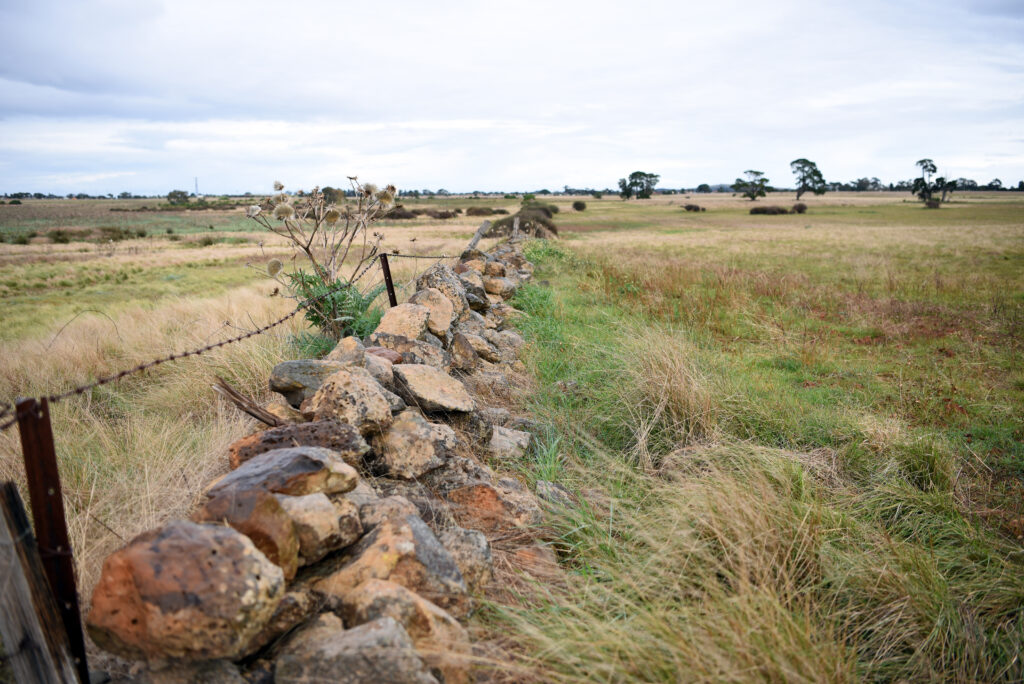
Historical rock wall found within the Melton East PSP
Interactive map of Melton East Precinct Structure Plan
Timeframes
The VPA and Minister for Planning have received the Standing Advisory Committee’s Report for the Melton East PSP and ICP. We are working with stakeholders to finalise the amendment for consideration by the Minister of Planning. The Committee’s Report will be released at the time of gazettal of the PSP, ICP, and Planning Scheme Amendment.
The PSP and ICP are currently being finalised. The Public Consultation documents released in March 2025 remain the most recent publicly available versions and can be found on the VPA Melton East webpage. At this stage, we are unable to comment on the specific contents of the PSP or the ICP while they are being finalised.
Land valuations will be finalised in April 2026 to inform the ICP. Following the Valuer General Victoria conferences, the PSP and ICP will be packaged for submission to the Minister for Planning in May.
About the project
A precinct structure plan (PSP) is a land use and infrastructure plan to guide the development of an area over time. It provides certainty for community members and developers by providing a long-term vision for how an area will develop in the future.
A PSP sets out the preferred locations of residential and employment land and infrastructure, and provides guidance for transport and parking, urban design, heritage and character, open spaces and integrated water management.
Together with the broader planning framework, precinct structure planning is an important part of the Victorian Government’s strategy to address population growth, housing and employment demands.
An Infrastructure Contributions Plan (ICP) is a system for funding basic and essential local infrastructure required by a new community. An ICP ensures that developers within the precinct contribute to the cost of providing new intersections, local open space and community facilities.
An ICP is prepared by a planning authority, usually a council or the Minister for Planning, or a public authority that has been authorised by the Minister, for example the Victorian Planning Authority. The Planning and Environment Act 1987 and the Ministerial direction on the preparation and content of Infrastructure Contributions Plans set out the requirements for the preparation and approval of an ICP.
An ICP may be made of one or two parts:
- Standard levy: A single levy that is used to fund transport, community and recreation infrastructure and public land provision. It is a pre-determined monetary rate set by the Minister for Planning through the Ministerial Direction, designed to provide a fair and reasonable budget for funding basic infrastructure essential for new urban development. The standard levy rates for the Metropolitan Greenfield Growth Areas development settings are indexed on 1 July each year in accordance with the indexation method specified in the Ministerial Direction.
- Supplementary levy: a non-standard levy set by the planning authority based on the estimated costs of infrastructure works informed by topographical, geographical, environmental or other physical constraints.
For more information, see Infrastructure Contributions Plans – FAQs.
The PSP has been prepared with the VPA Precinct Structure Planning Guidelines: New Communities in Victoria (2021) and PSP 2.0 process.
As part of this process, the VPA is leading the preparation of the PSP and planning controls for the Precinct in consultation with Melton City Council. The VPA is facilitating a whole-of-government approach, which includes consulting with all relevant stakeholders, including state government agencies, council, landowners, Traditional Owners and local residents and businesses.
For more detail on the planning process to date, including the extensive research and analysis that has been undertaken – please see the Background Report.
Infrastructure will be funded through a variety of sources, including as developer works as part of subdivision, through the Infrastructure Contributions Plan (ICP) and the Drainage Services Scheme (DSS).
The ICP will fund the delivery of essential infrastructure items, including transport infrastructure, three local sports reserves and four multipurpose community centres within the precinct.
Major drainage-related works will be funded through a DSS, to be managed by Melbourne Water.
A planning scheme amendment involves either a change to a planning scheme map, a change to the written part of the scheme, or both.
Amendments to a planning scheme can have significant planning implications as they change the way land can be used or developed, thereby changing the basis of planning decisions in the future.
The draft planning scheme amendment (draft amendment C244melt) has been prepared by the Victorian Planning Authority to implement the Melton East PSP and ICP into the Melton Planning Scheme. A planning scheme amendment is the most appropriate method for implementing the PSP to guide and provide certainty on future land use and development.
Changes to the zoning, overlay and particular provisions of the Melton Planning Scheme will be applied to facilitate development of the precinct. Specifically, the draft amendment proposes to:
- Insert a new Schedule 13 to the Urban Growth Zone and rezone land in the precinct to Urban Growth Zone 13 (UGZ13) and Rural Conservation Zone 3 (RCZ3).
- Apply an Environmental Audit Overlay (EAO) to land identified as having high risk for potential contamination.
- Applies the Heritage Overlay to the Beattys Road Nissen Hut (HO207).
- Include native vegetation exemptions in the Schedule to Clause 52.17 Native Vegetation of the Melton Planning Scheme.
- Applies the Public Acquisition Overlay (PAO) applied to land required for the Mount Cotrell Road / Western Freeway Interchange.
- Inserts Schedule 4 to the Infrastructure Contributions Overlay (ICO4) and applies it to the precinct.
Having your say
Submissions provided to the Victorian Planning Authority are part of an open public process where all parties affected by the planning scheme can provide input into the draft amendment.
If you choose to make a submission, you consent to your submission being made public, and being identified as the author of the submission.
Your submission will be made available for public inspection on the VPA website until two months after gazettal of the resulting planning scheme amendment and will also be made available to relevant Ministers and local councils, and other involved government agencies.
If you are a private individual, your personal information will be removed from your submission before it is released to parties outside government or local councils. Contact details do not include the address of land which is the subject of your submission.
By making a submission, you also give permission for copyright material to be copied and made public.
You can call the VPA project team at any time during business hours, Monday to Friday 9 – 5pm on 03 9651 9660 (Genna Walkley). You can also email the team via MeltonEast@vpa.vic.gov.au
Once a submission is made to the VPA, you will first receive a notice to acknowledge it has been received.
After the consultation period ends, VPA staff will review all submissions received. As part of this process, VPA staff may contact submitters as required to further discuss their submission and any changes sought.
If required, draft Amendment C295case may be subject to the VPA Projects Standing Advisory Committee (SAC). The SAC has been established to provide independent advice on draft planning scheme amendments to the VPA and the Minister for Planning.
While the VPA will seek to resolve issues raised by submitters, following the public consultation process, the Minister for Planning will be advised of the outcomes and provided with options to resolve submissions, including, but not limited to, referral to the SAC. If so, submitters will be contacted regarding next steps, process, and timing.
This is the final phase of consultation on the Melton East PSP and the only phase of consultation on Amendment C244melt to the Melton Planning Scheme.
If you make a submission, you may be invited to participate in a subsequent independent review process. Otherwise, this is your final opportunity to have your say on the strategic planning for the Melton East PSP.
Roles
The Victorian Planning Authority (VPA) is responsible for the planning of new suburbs and renewal sites in Victoria. The VPA is the Planning Authority for draft amendment C244melt – meaning that it is responsible for this amendment.
The VPA reports to the Minister for Planning while working closely with Melton City Council, government agencies and the community on integrated land use and infrastructure coordination for important development sites and precincts.
Our key priorities include unlocking land for new homes and communities, facilitating housing diversity and affordability, job creation and better development of new communities in growing and established areas.
Melbourne Water is the waterway, drainage and floodplain authority for the Port Phillip and Westernport region. They work with local Councils and government to ensure that appropriate drainage and water management infrastructure is in place to support increased demand, to protect people and property from flooding, and to protect our waterways.
Infrastructure and Development Staging
Infrastructure and development staging involves strategically planning and phasing projects over time to ensure efficient implementation and sustainability through the consideration of factors such as funding, regulations, and practicality.
An Infrastructure and Development Staging Plan (IDSP) facilitates development in preferred locations to mitigate sequencing that results in poor outcomes. It is based on a reasonable forecast of the preferred pattern and timing of development in the precinct.
The IDSP has been prepared to deliver the Development Services Scheme and outfall provisions, as well as other key transport infrastructure such as arterial roads and intersections to secure safe and efficient transport routes for new residents. There are no significant State-funded projects required to facilitate the development of the precinct.
How will this impact me?
The Melton East precinct will be urbanised with new homes, businesses and infrastructure. There will be new work opportunities for local residents, with approximately 2,000 new jobs expected to be generated alongside approximately 12,000 new homes. The PSP will also deliver new transport, drainage and community infrastructure, including facilitation of:
- New intersections along Melton Highway and Leakes Road, as well as several new intersections within the precinct;
- Two neighbourhood activity centres and two local convenience centres;
- Four government primary schools, a government secondary school and land for two non-government primary schools;
- Four multipurpose community centrse including kindergartens and meeting rooms for community use;
- A public open space network including a regional active open space facility, three active open space facilities and fourteen local parks.
If you choose to subdivide your land, a separate lot will need to be created for the conservation area, and an agreement must be entered with the Department of Energy, Environment and Climate Action. To find out more, please visit DEECA’s website.
Managing key issues
Flooding will be managed through new drainage infrastructure in the precinct. New drainage areas have been identified in the PSP and will be implemented as part of Melbourne Water’s Development Services Scheme (DSS) for the area. The DSS will ensure that development within the PSP is protected from flooding.
The PSP also includes Integrated Water Management strategies to enhance catchment resilience and manage existing and future flood risks and impacts.
The Melton East PSP area falls within the Melbourne Strategic Assessment (MSA) area under the federal Biodiversity Conservation Strategy, where the Growling Grass Frog is an endangered animal identified for protection.
The precinct contains part of Conservation Area 15 Western Growth Corridor: Growling Grass Frog corridors (north) under the MSA which is situated around Kororoit Creek. Conservation land will be zoned Rural Conservation Zone 3 (RCZ3) as part of the amendment to protect the land. The Crown will acquire the conservation land as development in the precinct occurs.
An arboricultural assessment was also undertaken to confirm the retention value of native vegetation within the precinct, and high-value trees are identified as ‘must be retained’ in the PSP.
Climate change has been considered within the plan through the incorporation of key elements such as open space, the Development Services Scheme, tree canopy enhancement, and integrated water management strategies. Additionally, the PSP emphasises achieving environmentally sustainable development (ESD) outcomes, such as a walkable built form and 20-Minute Neighbourhood, ensuring that the development will align with long-term environmental sustainability goals.
The VPA has procured an Aboriginal Cultural Heritage Impact Assessment for the Melton East precinct to identify areas of tangible cultural heritage. To further identify any tangible and intangible cultural heritage values, the VPA has also worked with the Wurundjeri Woi-wurrung Cultural Heritage Aboriginal Corporation (WWCHAC) to produce a Cultural Values Assessment (CVA). As part of the preparation of the CVA, the WWCHAC conducted a site ‘walk over’ and the PSP includes an Aboriginal Cultural Heritage Plan to show areas of significance.
A Cultural Heritage Permit was also granted to undertake excavations in indicative bridge crossing locations over Kororoit creek to provide additional cultural heritage information at the sites planned for Tarletons Road and Paynes Road bridges.
New planning controls/any overlays explained
The Urban Growth Zone (UGZ) designates land for future urban development, facilitating the transition from non-urban to urban use. It encourages the creation of well-planned, services urban communities in line with PSPs, streamlines approval processes in these areas, and protects non-urban land from activities that could impede its future urban development.
The Infrastructure Contributions Overlay (ICO) outlines requirements for monetary and/or land contributions within a specific area, often to secure land for public open space, sports grounds, community facilities and key infrastructure such as roads and intersections. Typically prepared by a planning authority like a municipal council or the Minister for Planning, its creation and approval follow guidelines set by the Planning and Environment Act and ministerial directives.
The Heritage Overlay (HO) is applied to identified heritage places where planning controls are required to conserve and enhance its significance. A planning permit is typically required to demolish or externally alter an existing building or to subdivide or construct a new building where a HO applies.
The Environmental Audit Overlay (EAO) ensures assessment of potentially contaminated land occurs before a new sensitive use begins. The EAO is typically applied where earlier land uses may have contaminated the land. Assessment of potentially contaminated land is done through the planning permit process.
The Public Acquisition Overlay (PAO) is applied to identified land to reserve it for a public purpose and indicates that this land could be compulsorily acquired in the future.