31/08/2017
Lindum Vale PSP on exhibition
The Victorian Planning Authority (VPA) and Hume City Council have prepared a plan to guide new urban development in Melbourne’s North.
The Lindum Vale Precinct Structure Plan (PSP) will go on formal exhibition on 31 August until 2 October 2017.
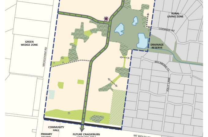
The new community will be 25km from Melbourne CBD, connecting to both the already approved Merrifield West Precinct and the existing Mt Ridley rural residential estate.
The plan consists of 144 hectares of land bounded by Mount Ridley Road to the south,Mickleham Road to the west, the Merrifield West Precinct Structure Plan (PSP) area to the north and the Mt Ridley rural residential area to the east.
Development of the precinct will create a high amenity urban environment.
The future 4,200 residents will enjoy access to 1,500 new homes, attractive open spaces, parks, well-designed streets and cycle-friendly infrastructure.
The new community will allow for convenient access to future education facilities, sporting reserves and community amenities such as a library, kindergarten and a maternal and child health centre.
The plan will extend the existing road network and widen Mt Ridley Road.
As part of community consultation, the VPA and Hume City Council will host a drop-in information session to provide stakeholders with an opportunity to discuss the plan on:
Tuesday 12 September 2017
4:30pm – 7:30pm
The Global Learning Centre
75 – 95 Central Park Ave, Craigieburn 3064
For further information and documentation please visit vpa.vic.gov.au/project/lindum-vale/.
Quotes attributed to Victorian Planning Authority Chief Executive Officer, Stuart Moseley:
“With Victoria growing, there is a high demand for affordable housing and infrastructure. This plan will create a well-designed neighbourhood that the community will be able to enjoy.”
