East of Aberline
The Victorian Planning Authority (VPA), in partnership with Warrnambool City Council and government agencies, is re-commencing the preparation of the East of Aberline Precinct Structure Plan (PSP) and Development Contributions Plan (DCP).
As background, the VPA commenced the East of Aberline project in 2019, prior to which Council had undertaken some work. However in 2020 as part of the Government’s response to COVID-19, the Treasurer and Minister for Planning required the VPA to accelerate 19 projects on our existing work program. East of Aberline amongst other projects were paused to refocus priority.
The East of Aberline precinct is expected to provide approximately 5,000 homes to accommodate a population of more than 15,000 people. It will also provide community facilities, local parks and potentially new schools. The VPA will work collaboratively with council to ensure the PSP considers the local community as well as the environment. A key focus of this precinct is to facilitate environmentally sensitive outcomes fit for the existing and future Warrnambool community and its resilience.
Public consultation is now closed
Public consultation on draft Amendment C217warr to the Warrnambool Planning Scheme is now closed. We are now reviewing all submissions and will reach out to submitters as required.
If you have any questions please contact us via EastofAberline@transport.vic.gov.au
For more information, refer to Engage Victoria – East of Aberline.
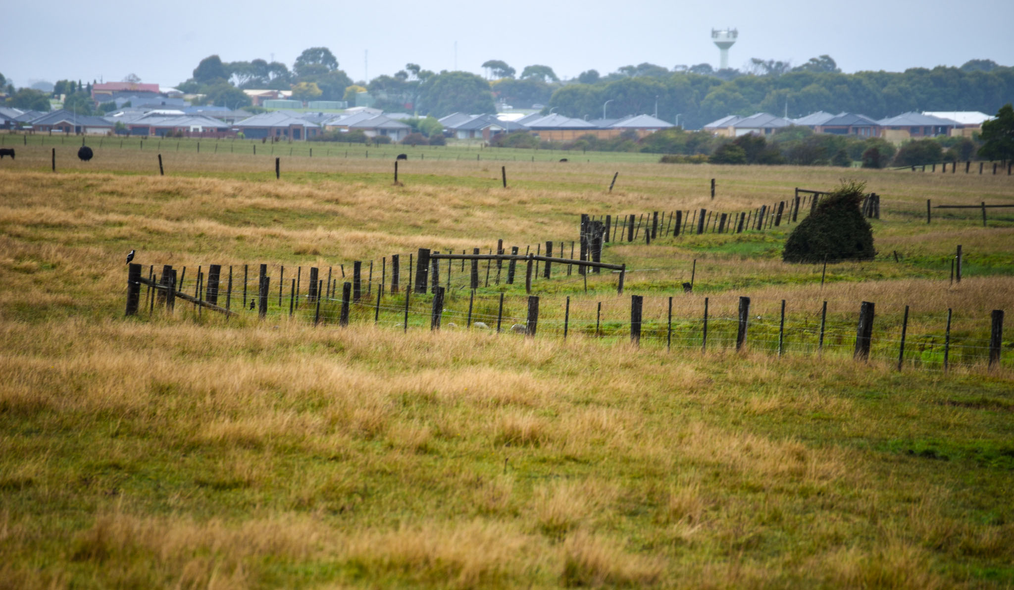
Looking west across Russell Creek towards Aberline Road
Landowners – Register Your Information
As part of the PSP process, the VPA is required to undertake technical work on matters such as biodiversity, heritage (Aboriginal and European), arboricultural, land capability and others. Access to your site will be critical to undertaking this work and enable creation of an informed PSP.
If you are a landowners in the Precinct we request permission to grant access to your property, and would appreciate if you can please fill out the attached form and return it via email to the project team.
For more information, refer to Consent to Access Land for Land Assessments form (Word)
The VPA or its representatives will always seek to notify you of any intention to enter your property to support planning investigations.
About the project
The East of Aberline Precinct Structure Plan will assist in delivering much needed land for new homes, services and jobs while addressing the city’s low residential land supply as Warrnambool’s future long-term growth area.
On 20 September 2023, the Victorian Government released Victoria’s Housing Statement: The decade ahead 2024-2034, in which it announced the Victorian Planning Authority will continue preparing precinct structure plans (PSPs) for new housing and jobs in Melbourne and regional Victoria. These projects will deliver a sustainable supply of greenfield land and more jobs close to home. The East of Aberline PSP has been identified as one of twenty-one priority planning projects which will contribute towards the housing supply in Victoria.
Providing more land for housing means Victorians will have access to a range of homes that suit different needs, budgets and lifestyle choices. This includes houses, townhouses and units. Increasing housing supply helps put downward pressure on housing prices and contributes to making housing more affordable.
The VPA’s plan offers an exciting opportunity for Warrnambool to grow while delivering connected urban neighbourhoods with high amenity. This will be achieved through integrated transport to provide access to local jobs, destinations and services for its future residents.
Coordinated and comprehensive planning for key precincts, such as East of Aberline, ensures the city can grow while preserving its local identity.
East of Aberline has been set aside for urban development for more than a decade. It was identified through the_City-wide Housing Strategy 2013.pdf. The Warrnambool City-wide Housing Strategy (2013) identifies East of Aberline Road (North-East Warrnambool) as one of Warrnambool’s future long-term greenfield growth areas to address the city’s low residential land supply. The Strategy also identifies the provision of social housing as an emerging issue that needs to be considered in future growth area planning.
This planning scheme amendment includes a change to the boundaries of the PSP. In July 2019, Warrnambool City Council requested VPA to become Planning Authority, and in September 2019, the Minister for Planning appointed VPA Planning Authority. At this time, the project boundary included the entirety of the properties at 150 and 210-214 Horne Road. In 2021 the owners of 53 Rodgers Road Warrnambool (a 15ha property) requested that their property be included in the PSP boundary because the land was partly identified within the existing settlement boundary. The VPA investigated the request and identified that the request should be implemented, and that the small 2ha property at 75 Rodgers Road Warrnambool should also logically be included in 2024. Further information about the boundary change can be found in the East of Aberline PSP Background report.
A Precinct Structure Plan (PSP) is a land use and infrastructure plan to guide the development of an area over time. It sets out the preferred locations of residential and employment land and infrastructure, and provides guidance for transport and parking, urban design, heritage and character, open spaces and integrated water management.
Together with other planning controls, it sets the rules for what can be built in the precinct and under what conditions, including conditions for developing where there are constraints and opportunities.
A Development Contributions Plan (DCP) establishes a framework for developers to make a financial contribution towards the cost of key infrastructure projects, providing certainty for the future community around infrastructure timing, funding and delivery.
The DCP for East of Aberline is based on detailed assessments across transport, community infrastructure, drainage, and utilities, and sets out the infrastructure items required to support the new community.
Together, the PSP and DCP will provide a broad framework that coordinates development and supports the transition of the area from its current farming use and rural character into an urban residential growth area for Warrnambool.
To facilitate implementation, an amendment to the Warrnambool Planning Scheme is proposed to rezone the land from Farming Zone (FZ) to appropriate residential and associated zones.
Development will occur progressively over the next 20–30 years in response to market demand.
Warrnambool City Council is the responsible authority for the PSP area and will assess planning permit applications for subdivision and development in accordance with the PSP and DCP.
Developers are responsible for lodging planning applications that align with the vision and outcomes of the PSP and DCP, including infrastructure contributions and delivery requirements.
The East of Aberline PSP will deliver a new community that includes:
- A range of housing types and lot sizes to support affordability, diversity, and demographic change
- A neighbourhood activity centre including a supermarket and shops
- A new government primary school site
- Local community facilities
- An active open space reserve for sports and play
- A network of local parks and shared paths linked along Russell Creek and Tozers Reserve
Land has been reserved for a new government primary school in response to forecasted demand. The timing of this school’s delivery will be determined by the Department of Education.
The PSP has been prepared by the VPA in collaboration with Warrnambool City Council, State Government agencies, utility providers, Traditional Owners, and other stakeholders.
The plan is based on detailed technical investigations and considers the site’s natural features, cultural heritage, and the needs of future residents. Studies undertaken include:
We have prepared the following technical investigations to draft our plans:
- Stormwater drainage and flood management
- Community facilities and open space
- Transport and movement
The Development Contributions Plan (DCP) has been created based on a range of technical water, transport and community assessments. These assessments are available on the VPA project page. The identified items have been incorporated into the DCP, with their delivery scheduled based on the precinct’s demand.
The DCP is informed by technical assessments and agency input. Infrastructure has been identified to meet the demands of the future population and to deliver:
- Road upgrades, intersections, and shared paths
- Stormwater basins and drainage corridors, including along Russell Creek
- Land and construction contributions for community infrastructure
- Utility connections and service upgrades
This infrastructure was identified in consultation with Warrnambool City Council, Wannon Water, the Department of Transport and Planning, Department of Education and Glenelg Hopkins Catchment Management Authority.
A planning scheme governs the way land can be used and developed within the bounds of the Victorian Planning System. A planning scheme is updated from time to time via an amendment process to change the way land can be used or developed.
The planning scheme amendment will introduce the PSP, DCP and other ordinance into the Warrnambool Planning Scheme that will govern how land and infrastructure are delivered within the PSP area into the future.
Warrnambool City Council is the responsible authority who administers the Warrnambool Planning Scheme and any future planning applications will need to adhere to its conditions.
Any proposed changes to a planning scheme, such as the incorporation of the PSP, must go through a public consultation process. See the ‘Having your say’ section below for more information.
Background information
The Victorian Planning Authority (VPA) is a State Government statutory authority within the Department of Transport and Planning that reports to the Minister for Planning.
The VPA’s main task is to make sure Melbourne and Victoria’s regions remain great places to live and work. This requires vision and long-term planning to ensure our growing population has equitable access to employment, public transport, attractive public spaces and affordable housing.
Our key priorities include unlocking land for new homes and communities, facilitating housing diversity and affordability, job creation and better development of new communities in growing and established areas.
We do this by working closely with councils, government agencies and the planning and development community on integrated land use and infrastructure coordination for new communities and strategically important precincts.
A Precinct Structure Plan (PSP) is a land use and infrastructure plan to guide the development of an area over time. It provides certainty for community members and developers by providing a long-term vision for how an area will develop in the future.
A PSP sets out the preferred locations of residential and employment land and infrastructure, and provides guidance for transport and parking, urban design, heritage and character, open spaces and integrated water management.
Together with the broader planning framework, precinct structure planning is an important part of the Victorian Government’s strategy to address population growth, housing and employment demands.
A Development Contributions Plan (DCP) identifies the costs of some essential infrastructure required to support a PSP such as the costs of signalised intersections, drainage corridors, retarding basins, and others. It will also set out a levy required for new development on a ‘per hectare of net developable area’ basis.
The DCP is required since broad scale new development often contribute to or cause the need for new or upgraded infrastructure. It ensures that existing infrastructure is not over-burdened by new development.
The DCP will be prepared concurrently with the PSP. All infrastructure items included must be strategically justified through the suite of background studies undertaken on the project. The DCP becomes a public document to be publicly exhibited along with the PSP.
Project information
The Precinct Structure Plan (PSP) guides development of an area over time, however, it does not compel a landowner to develop their land if they wish to remain undeveloped.
The precinct boundary has been informed by the Warrnambool Planning Scheme and in particular the Warrnambool Strategic Framework Plan at Clause 02.04 in addition to consultation with state agencies, Warrnambool City Council and technical consultants.
PSP boundaries are established to create logical and manageable ‘planning areas’ for the preparation of Precinct Structure Plans and associated Development Contributions Plans.
The Victorian Planning Authority (VPA) is partnering with Warrnambool City Council to prepare strategic planning outputs.
Once a project is completed, the Responsible Authority for implementing it over many years (e.g. approving subdivision applications) will usually be the local council. To assist in facilitating this, the VPA ensures regular engagement with council throughout the whole life of the project.
Having your say
Submissions provided to the Victorian Planning Authority are part of an open public process where all parties affected by the planning scheme can provide input into the draft amendment.
If you choose to make a submission, you consent to your submission being made public and being identified as the author of the submission.
Your submission will be made available for public inspection on the VPA website until two months after gazettal of the resulting planning scheme amendment and will also be made available to relevant Ministers and local councils, and other involved government agencies.
If you are a private individual, your personal information will be removed from your submission before it is released to parties outside government or local councils. Contact details do not include the address of land which is the subject of your submission.
By making a submission, you also give permission for copyright material to be copied and made public.
You can call the VPA project team at any time during business hours, Monday to Friday 9 – 5pm on 03 9651 9600 (Gareth Hately – Strategic Planning Manager). You can also email the team via eastofaberline@transport.vic.gov.au
Once a submission is made to the VPA, you will first receive a notice to acknowledge it has been received.
After the consultation period ends, VPA staff will review all submissions received. As part of this process, VPA staff may contact submitters as required to further discuss their submission and any changes sought
If required, draft Amendment C217 may be subject to the VPA Projects Standing Advisory Committee (SAC). The SAC has been established to provide independent advice on draft planning scheme amendments to the VPA and the Minister for Planning.
While the VPA will seek to resolve issues raised by submitters, following the public consultation process, the Minister for Planning will be advised of the outcomes and provided with options to resolve submissions, including, but not limited to, referral to the SAC. If so, submitters will be contacted regarding next steps, process and timing.
This is the final phase of consultation on the East of Aberline PSP and the only phase of consultation on Amendment C217 to the Warrnambool Planning Scheme.
If you make a submission, you may be invited to participate in a subsequent independent review process. Otherwise, this is your final opportunity to have your say on the strategic planning for the East of Aberline PSP.
In future, there may be opportunities to have your say on some more detailed components of East of Aberline’s development and design, such as the designs of specific open spaces run by council.
How can I get involved?
The best way to stay involved in the plan development process is to register your interest in the project on the project website. If you would like to learn more, feel free to contact members of the project team.
Vegetation and Flood Risk
The precinct contains existing ecological and conservation values and revegetation/re-habitation opportunities, including the native vegetation, potential roosting habitat and waterway conservation corridor.
How does our plan manage existing vegetation and support ongoing conservation?
- The precinct has designated conservation areas along Russell Creek and to the Tozer Reserve and surrounding vegetation for ongoing conservation.
- The conservation areas will be buffered from the impacts of urban development by designating vegetation management buffers, parks and public reserve. The ongoing conservation will be also supported by abutting new development that must provide a conservation masterplan to support re-habitation for species such as Growling Grass Frogs.
- New development will be required to protect existing native vegetation and incorporate the retention and revegetation into the landscape plan.
The precinct currently includes land that is subject to inundation in a 1% Annual Exceedance Probability (AEP) event. Climate change has been factored into the 1 in 100 AEP flood estimation in accordance with the BoM Intensity-Frequency-Duration 2016.
We have undertaken extensive flood modelling to determine the impacts of 1% AEP flooding, under current and future climate changes, and to ensure no increase in flooding downstream or offsite is created by the precinct.
Flooding in the precinct is associated with Russell Creek, a tributary of the Merri River. Key flood management features in the plan include:
- No new development in high flood hazard areas
- Protecting and enhancing the Russell Creek floodplain
- Temporary storage of floodwaters via drainage basins and wetlands
- An urban standard stormwater drainage system
The Victorian Planning Authority, Warrnambool City Council and Glenelg Hopkins CMA have developed a stormwater management strategy for the precinct to ensure that future development is resilient to flood events, including the impacts of climate change.
Flood and drainage solutions for the East of Aberline PSP were based on:
- Technical reports by Spiire and SMEC (available on the VPA’s project webpage)
- Input from Glenelg Hopkins CMA and Warrnambool City Council
- Updated modelling using the latest data and storm event scenarios
- Integrated Water Management (IWM) principles to support biodiversity and amenity as well as drainage
Who has been involved?
The Victorian Planning Authority (VPA) is a Victorian Government statutory authority that plans for urban growth across Victoria. It reports to the Minister for Planning.
The VPA’s role is to ensure that Melbourne and Victoria’s regional cities and towns remain great places to live and work. This requires vision and long-term planning to ensure our growing population has equitable access to jobs, transport, public spaces, and affordable housing.
For East of Aberline, the VPA has led the preparation of the Precinct Structure Plan (PSP), Development Contributions Plan (DCP) and associated planning scheme amendment. This work has been undertaken in close collaboration with Warrnambool City Council, State Government agencies, Traditional Owners, and other stakeholders.
The VPA and the Warrnambool City Council have worked collaboratively to prepare the East of Aberline PSP, development contributions plan (DCP) and associated planning scheme controls. Warrnambool City Council is a partner in this engagement process, supporting the VPA as the lead agency for the amendment.
Once the planning scheme amendment is finalised, Warrnambool City Council will be the responsible authority for administering the planning controls. This means the Council will assess future planning permit applications for subdivision and development in the precinct to ensure they align with the PSP and DCP.
Council is also the designated drainage authority and will review any drainage proposals to ensure they meet stormwater management and flood protection requirements.
Where land is reserved for future public purposes and identified with a Public Acquisition Overlay (PAO), Warrnambool City Council will be the acquiring authority.
The VPA has led the PSP preparation with ongoing input and technical advice from Warrnambool City Council. The Council has helped shape the plan, including infrastructure priorities, drainage design, open space planning, and staging of development.
The VPA also coordinated whole-of-government consultation throughout the planning process to ensure alignment with Council and State Government objectives.
Glenelg Hopkins Catchment Management Authority (GHCMA) is the floodplain management authority responsible for maintaining the natural functions of floodplains and waterway of Russell Creek.
GHCMA has provided input into the stormwater and flood management strategy for the East of Aberline PSP. All flood modelling conducted as part of the PSP process has been consulted with GHCMA to ensure that future development is resilient to flooding and does not increase flood risk downstream or off-site.
Wannon Water is the water authority responsible for water supply and sewerage in Warrnambool, including the East of Aberline PSP area.
Acquisition of land for public purposes (Public Acquisition Overlay)
It is common for council to need to acquire land as part of new development to meet the needs of a new or existing community. Land acquisition is a mechanism that is employed to reserve land, assist in delivery of new or upgrades to essential infrastructure and to improve public safety.
For example, land required for flood management and to build infrastructure (i.e. new roads and intersections) are often acquired by council to ensure that these projects can be delivered and be managed by council into the future.
We understand that finding out your land needs to be acquired is confronting. The VPA’s advice should not be relied on in place of seeking independent legal advice and referring to the Land Acquisition and Compensation Act
A Public Acquisition Overlay (PAO) reserves land for a public purpose and indicates that your land has been designated for compulsory acquisition. The PAO may also restrict the use and development of your land.
PAOs are a legislated planning tool and, once approved via a Planning Scheme Amendment, will form part of the Warrnambool Planning Scheme.
There is no expiry date for PAO. They can be placed on land indefinitely, until that land is required for its intended purpose. In the future, if it is determined that your land is no longer required for the intended purpose, the PAO will be removed.
You will be contacted directly by the Victorian Planning Authority (VPA) to advise if your land has been identified for compulsory acquisition and will be given an opportunity to express your views. Land identified in the Precinct Structure Plan (PSP) for compulsory acquisition means it is subject to the Public Acquisition Overlay (PAO).
As new development occurs, infrastructure needs to be delivered to support current and future communities. For example, roads, local parks, community or flood management infrastructure. At times, this requires compulsory acquisition of private land to deliver.
Without a PAO, council’s ability to acquire land for delivery and management of essential infrastructure can be impacted. This would result in new communities being inadequately serviced or having future safety risks.
| PAO required to manage flooding and vegetation | PAO required to deliver essential community infrastructure and open space | PAO required to deliver essential road network |
|
|
|
Land affected by a PAO will be acquired based on the development needs of the precinct. The precinct will be built in stages and the supporting infrastructure will depend on the stage of construction.
You will be notified directly by council prior to the need to acquire your land and to advise you of the process and timeframes for this to occur. Council is the acquiring authority for all land designated with a PAO within the PSP.
The process that must be followed to acquire land is set out in the Department of Transport and Planning Guide to the Victorian Planning System: Acquisition and compensation.
If your land is acquired, you will be compensated in accordance with the Land Acquisition and Compensation Act 1986. This Act outlines the process for assessing compensation.
The assessment of compensation under the Land Acquisition and Compensation Act 1986 will consider:
- Your responses to the Notice of Intention to Acquire (NOITA)
- Market value (including severance)
- Special value
- Loss attributable to disturbance
- Professional expenses
The Act also outlines a disputes process in the event council and the landowner fail to agree upon compensation. To find our more, visit the Department of Transport and Planning Guide to the Victorian Planning System: Acquisition and compensation.
If a PAO applies to your land, and you wish to undertake certain building and works (such as building a shed), a planning permit may be required from council. Each proposal is reviewed individually. To have a better understanding of what you can and cannot build upon your land impacted by a PAO, the VPA advises you speak directly with council.
Development staging refers to the order (or sequence) in which development occurs throughout a precinct. Staging is a way of achieving an orderly and economic progression of development within a precinct structure plan (PSP).
Staging seeks to ensure demand fort zoned land can be met while aligning the provision of future infrastructure capacity.
The aim of development staging is to align the subdivision and development within a PSP area with the required infrastructure delivery. This ensures new communities are appropriately serviced and supported by transport, community, and drainage infrastructure. This includes the consideration and capacity of existing and future infrastructure.
A preferred outcome is that each stage of a precinct will enable enough development fronts and individual estates to be developed concurrently so that there can be a competitive land market with choice for consumers.
Staging is not a means of creating a commercial advantage for some landowners over others. It is not intended to create a “queue” where those at the “head of the queue” can control the pace of land development.
Infrastructure and Development Staging
While precinct structure plans set out the high-level intentions for a precinct, and provides detailed information setting out the required transport, drainage and community infrastructure required to serve a precinct, there is often a time-lag or disconnect between the delivery of land for housing or employment and the delivery of necessary infrastructure needed to service the new community.
This can lead to new residents and workers experiencing traffic congestion, lack of community infrastructure and a lack of public transport which in turn increases car dependency. These are not optimal outcomes and the VPA is hoping to change that.
It is critical that infrastructure to support development of growth areas is delivered in a timely and coordinated manner.
As a planning authority, the VPA is responsible for PSPs that are consistent with both the planning guidelines set out in the Precinct Structure Planning Guidelines: New Communities in Victoria (2021) and relevant state policy.
The 2021 PSP Guidelines detail how the VPA must draft our precinct plans. The PSP Guidelines require new PSPs to account for the location and timing of development, and to identify trigger points for the provision of required infrastructure. This information is contained in the Infrastructure and Development Staging Plan.
As set out in Victoria’s Housing Statement: The Decade Ahead 2024-34 (September 2023), planning for growth areas remains important – but it is important to support that growth in our suburbs by ensuring that this is delivered in line with building transport and infrastructure to connect people to jobs and services.
An Infrastructure and Development Staging Plan (IDSP) identifies the preferred pathway for infrastructure and development in a Precinct Structure Plan (PSP). The plan facilitates infrastructure and development in preferred locations. It outlines which infrastructure is required at what point based on development demands.
The plan will spatially identify the location of each development stage, together with the infrastructure needed to support each stage and enable progression to subsequent stages.
The purpose of the plan is to mitigate poor outcomes for those living and working in a new precinct that might arise through a misalignment in the delivery of infrastructure to support a new community and staging of development.
The first stage of the precinct to be built will usually be the area not reliant on the delivery of critical state infrastructure. For example, upgraded arterial road intersections, bridge crossings or freeway interchanges.
Usually this will be land where existing infrastructure already has capacity to accommodate growth, or where there are plans or commitments in place that give the necessary level of confidence that it can and will be provided.
Considerations for identifying the first stage include:
- Logical road gateways for early road infrastructure delivery
- Appropriate locations for early drainage infrastructure delivery
- Access to existing public transport infrastructure
- Access to utilities infrastructure
- Proximity to existing town centres and community infrastructure
The remaining new infrastructure can be funded through developer contributions and provided as development proceeds within the stage.
The VPA undertakes a detailed analysis to determine staging within a precinct. The analysis considers the local context, known state funding commitments, locations and likely rates of development, local infrastructure provision and background technical studies for traffic, transport and drainage. The VPA also completes a detailed financial analysis. This analysis considers projected cash flow over time and compares this against expenditure on the infrastructure items within the Precinct Infrastructure Plan (PIP).
The aim is to avoid an imbalance between revenue and expenditure regarding infrastructure provision. Where infrastructure is required to ‘unlock’ and provide for orderly development prior to infrastructure contributions being available, consideration is given to the mechanisms needed to align development staging and infrastructure provision.
This is particularly critical when considering the first stage, to ensure there is essential infrastructure for those who are the first residents living, and employees working, in a new community.
All future PSPs will include some level of provision applied to use and development (including subdivision) to implement the staging plan. In exceptional cases, use and development (including subdivision) may be prohibited until the required infrastructure is delivered. This may be required due to insufficient capacity of existing infrastructure and the need to build new infrastructure before new development can proceed.
Existing residents and businesses will usually be allowed to make minor changes and alterations to their properties under the provisions of the Urban Growth Zone – Part A (UGZA), the intent is that material or substantial development will not occur outside of the staging guidance in the PSP.
Note: ‘Development’ is defined by the Planning and Environment Act 1987. This definition includes subdivision.
In some cases, the capacity of existing infrastructure is already exceeded due to existing development in the surrounding area. This means there is no capacity to accommodate any new development.
Therefore, additional measures are required to control – and possibly prohibit – development within the PSP area until there is certainty of delivery of new infrastructure. For example, opening a new freeway interchange.
It is not acceptable to create new allotments if they cannot be provided with safe and sufficient movement and access to their new community.
Timing new development appropriately with delivering essential infrastructure results in better planning and community outcomes.
Anyone can make a formal written submission and provide feedback on the staging approach during the public consultation process. The VPA will review all submissions to address concerns wherever possible. As part of the consultation process, the VPA will contact submitters if further clarification is required.
While the VPA is committed to providing strong staging guidance, we invite comment and input on ways the VPA can achieve the intent and approach in our precincts.
For local infrastructure projects funded by a Development Contributions Plan (DCP), a developer or landowner can propose a Work-In-Kind (WIK) agreement with the relevant collecting agency (usually Council). There is no right of review if a collecting agency refuses to accept a WIK proposal.
New planning controls explained
The UGZ applies to land that has been identified for future urban development. The UGZ:
- manages the transition of non-urban land into urban land
- encourages the development of well-planned and well-serviced new urban communities, generally in accordance with a precinct structure plan
- reduces the number of development approvals needed in areas where a precinct structure plan is approved
- safeguards non-urban land from use and development that could prejudice its future urban development.
The Development Contributions Plan Overlay (DCPO) is the planning scheme tool that is being employed to collect financial contributions from developers towards the planned infrastructure that is listed in the DCP.
A developer will be required to pay the development contribution prior to the issue of the building permit.
Payment of a development contribution applies to all development requiring a planning permit. However, the following some types of development are exempt:
· Non- government schools
· Development that comprises renovations or alterations to an existing dwelling, demolition of a dwelling and replacement with a new dwelling and outbuildings and fences normal to a dwelling (the exemption does not apply to works associated with a second or subsequent dwellings on the same land); and
· Reinstatement of a building which has been unintentionally damaged or destroyed, provided that the floor area of the new building is not greater than the damaged or destroyed building.
An Environmental Audit Overlay (EAO) is included in the draft planning scheme amendment. It applies to properties within the precinct that have been nominated as having a high potential for contamination.
The EAO requires the affected property to undergo an further assessment before any work can commence for any ‘sensitive uses’, such as housing, a primary school, playground, kindergarten, or early childhood centre.
The VPA has written to all affected landowners requesting that they undertake a Preliminary Risk Screen Assessment (PRSA) to determine whether an environmental audit is required on their property. PRSAs are underway on several affected properties, and the outcome of these assessments may inform refinements to the ultimate extent of the EAO within the precinct.
More information on the use of the Environmental Audit Overlay (EAO) can be found at environment.vic.gov.au/sustainability/victoria-unearthed/about-the-data/environmental-audit-overlay
The PSP also identifies several properties with a medium potential for contamination. These properties will also need to prepare further assessments and meet any conditions specified in further assessments before any work for sensitive uses can begin.
The Heritage Overlay is applied to individual place to protect places of heritage significance. If you have a Heritage Overlay on your property you are likely to need to apply to council for a planning permit for certain types of building and works. This is to ensure that the proposed development does not detract from the heritage significance of the place.
Tozer Reserve will within a Public Conservation and Resource Zone applied zone. The purposes of this zone include:
“To protect and conserve the natural environment and natural processes for their historic, scientific, landscape, habitat or cultural values.
To provide facilities which assist in public education and interpretation of the natural environment with minimal degradation of the natural environment or natural processes.”
In recognition of the land being managed by the Department of Education and in recognition of the Aboriginal significance and ecological values of this site, the application of this public land use zone will preserve the site’s ecological significance and perpetuate the use of the land for educational purposes.
How will this impact me?
East of Aberline’s transformation will be gradual and is expected to occur over decades (20-30 years.)
This planning will gradually change the area you live or work in over a long period of time. The precinct will transition from a predominantly farming area to a residential precinct. You may notice changes as new development occurs in addition to significant investment in community infrastructure and new open spaces.
The interruption caused by building and development will only commence once the planning scheme amendment is gazetted and the planning permit approvals process for development occurs.
DCP funds collected by Council as part of future development will be used to support delivery of essential infrastructure in the precinct structure plan. This will also minimise the impact to existing money collected via rates.
The precinct is owned by private land and/or business owners.
Who is involved?
The Department of Transport and Planning centralises key planning and land use activities, precinct and policy functions in a single department. The Department of Transport and Planning (DTP) integrates planning, transport and infrastructure functions across Victoria.
DTP’s transport division has contributed to decisions on state road connections and shared path infrastructure in the East of Aberline PSP. Any planning applications that affect the broader declared road network will be referred to DTP as a determining authority.
DTP’s planning division is responsible for reviewing draft PSPs and supporting the statutory process for planning scheme amendments. DTP Planning has reviewed and endorsed the draft PSP and DCP for exhibition.